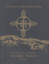
New Mexico Geological Society
Fall Field Conference Guidebook - 14
Socorro Region

Frederick J. Kuellmer, ed., 1963, 204 pages, (reprinted 1996).
Welcome to Socorro County! This year we are trying out a new recipe for the field conference. Those of us who agree with Professor H. H. Read that "The best geologist is he who has seen the most rocks" have long wondered whether past field conferences were in fact showing us the rocks we came to see. Was too much time being spent in a speeding car? Were the logistics of maintaining more than 200 people hundreds of miles from home becoming too complicated? This year the emphasis is on small groups, short drives, and long stops at critical exposures. There are 10 field trips to choose from, covering the geology of the Western Bear Mountains, the Joyita Hills, the hydrology of the Socorro area, the Nogal Peak mining district, Socorro Peak and Socorro Mountains, Ojo de la Parida including the Yeso type locality, the Carthage area, Sais quarry and Monotosa thrust fault, New Mexico Insititute of Mining and Technology Seismograph Station, Socorro Mountain, and Water Canyon and South Baldy Peak, Magdalena Mountains. Accompanying these 10 field trips are additional roadlogs along the main highway routes for the above trips.
Table of Contents:
Note —Downloads of the papers below are free. Road logs, mini-papers, and some other sections of recent guidebooks are only available in print.
Front Matter: (includes Dedication, President's Message, & Conference Organizer's Message)
Download (594 KB PDF)
Roadlogs: (each includes listed mini-papers)
— Roy W. Foster and Philip Luce, pp. 6-12. https://doi.org/10.56577/FFC-14.6
— Roy W. Foster and Philip Luce, pp. 13-19. https://doi.org/10.56577/FFC-14.13
— Robret H. Weber and M. E. Willard, pp. 20-25. https://doi.org/10.56577/FFC-14.20
— Roy W. Foster and Philip Luce, pp. 26-30,. https://doi.org/10.56577/FFC-14.26
— Roy W. Foster and Philip Luce, pp. 31-37. https://doi.org/10.56577/FFC-14.31
— Robert H. Weber and M. E. Willard, pp. 38-41. https://doi.org/10.56577/FFC-14.38
— F. J. Kuellmer and F. E. Kottlowski, pp. 42-52. https://doi.org/10.56577/FFC-14.42
— Hall, Francis, R., pp. 53-60. https://doi.org/10.56577/FFC-14.53
— George B. Griswold, pp. 60-66. https://doi.org/10.56577/FFC-14.60
— Clay T. Smith, pp. 66-68. https://doi.org/10.56577/FFC-14.66
— Robert A. Bieberman, pp. 69-73. https://doi.org/10.56577/FFC-14.69
— Antonius J. Budding, pp. 74-77. https://doi.org/10.56577/FFC-14.74
— Antonius J. Budding, pp. 78. https://doi.org/10.56577/FFC-14.78
— Allan R. Sanford, pp. 79. https://doi.org/10.56577/FFC-14.79
— Antonius J. Budding, pp. 80-85. https://doi.org/10.56577/FFC-14.80
— Frank E. Kottlowski, pp. 86-87. https://doi.org/10.56577/FFC-14.86
— G. C. Evans and Philip Luce, pp. 88-95. https://doi.org/10.56577/FFC-14.88
Papers:
— George B. Griswold, pp. 97. https://doi.org/10.56577/FFC-14.97
— Anonymous, pp. 98-99. https://doi.org/10.56577/FFC-14.98
— Anonymous, pp. 100-101. https://doi.org/10.56577/FFC-14.100
— Frank E. Kottlowski, pp. 102-111. https://doi.org/10.56577/FFC-14.102
— Augustus K. Armstrong, pp. 112-122. https://doi.org/10.56577/FFC-14.112
— Bruce DeBrine, Z. Spiegel, and D. Williams, pp. 123-131. https://doi.org/10.56577/FFC-14.123
— Robert H. Weber, pp. 132-143. https://doi.org/10.56577/FFC-14.132
— Robert H. Weber, pp. 144-145. https://doi.org/10.56577/FFC-14.144
— Allan R. Sanford, pp. 146-151. https://doi.org/10.56577/FFC-14.146
— Charles R Holmes, pp. 152-154. https://doi.org/10.56577/FFC-14.152
— Francis X. Bushman, pp. 155-159. https://doi.org/10.56577/FFC-14.155
— Hall, Francis, R., pp. 160-179. https://doi.org/10.56577/FFC-14.160
— Lawrence J. Herber, pp. 180-184. https://doi.org/10.56577/FFC-14.180
— Clay T. Smith, pp. 185-196. https://doi.org/10.56577/FFC-14.185
— Richard W. Geddes, pp. 197-203. https://doi.org/10.56577/FFC-14.197
— Antonius J. Budding and Dan J. Hartman, pp. 204-208. https://doi.org/10.56577/FFC-14.204
— George C. Evans, pp. 209-216. https://doi.org/10.56577/FFC-14.209
— Anonymous, pp. 217-219. https://doi.org/10.56577/FFC-14.217
— Robert H. Weber and William A. Bassett, pp. 220-223. https://doi.org/10.56577/FFC-14.220
— W. H. Burke, G. S. Kenny, J. B. Otto, and W. H. Burke, pp. 224. https://doi.org/10.56577/FFC-14.224
— Robert H. Weber, pp. 225-233. https://doi.org/10.56577/FFC-14.225
— Paige W. Christiansen, pp. 234-239. https://doi.org/10.56577/FFC-14.234
Recommended Guidebook Citation:
- Kuellmer, F. J.; [ed.], 1963, Socorro Region, New Mexico Geological Society, Guidebook, 14th Annual Field Conference, 204 pp. https://doi.org/10.56577/FFC-14